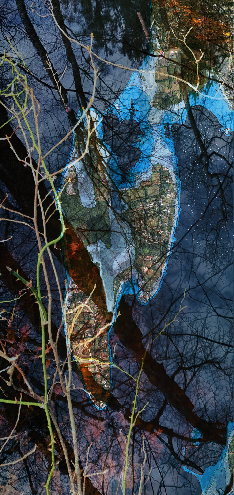
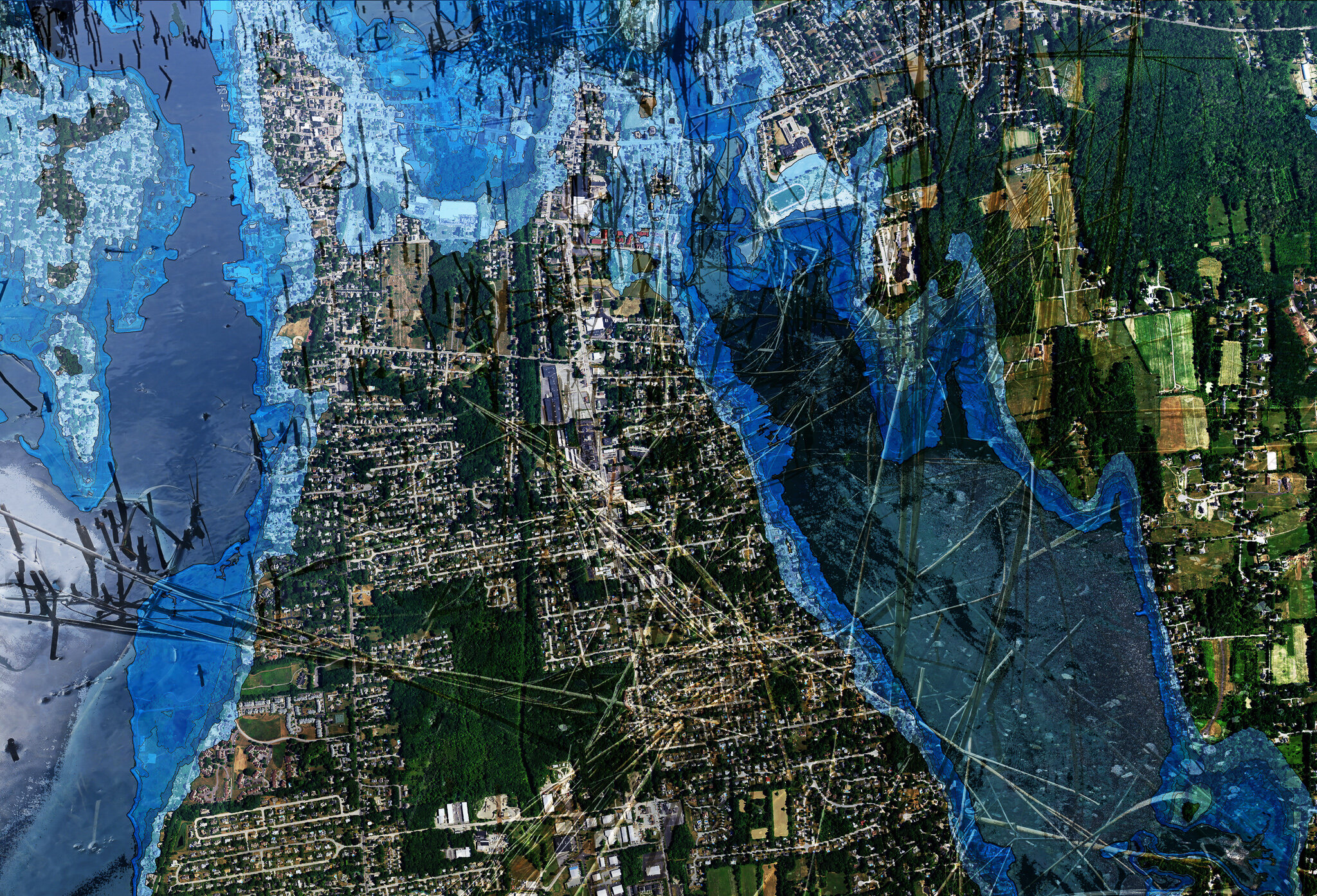
These images are available for sale in several different sizes and formats. If you are interested in discussing the options that are available, please email me at linmeg42@gmail.com so we can discuss. I will donate 10% of the proceeds from sales associated with this project to Warren Land Conservation Trust saltmarsh restoration efforts.

Rising Seas

Bristol County, RI:
2050 - 2100

Climate change is nothing new, although the projections and realities of its devastating impact become more apparent every day.

For this project, I decided to stay close to home and focus on projections of sea level change and 100-year storms for Bristol County, RI, where I live.

Bristol County, which includes the municipalities of Barrington, Warren and Bristol, is projected to be especially hard hit by sea level rise because of its location at the head of Narragansett Bay. In short, there is nowhere for surging seas to go except over land and, in many cases, that land is densely populated.

For help, I turned to Teresa Crean, former AICP Coastal Community Planner at the Coastal Resources Center, RI Sea Grant, Graduate School of Oceanography at the University of Rhode Island and now director of Planning, Building & Resiliency in Barrington, RI. Ms. Crean guided me to sea level rise inundation projections and aerial photographs provided by Esri, HERE, NPS / RIGIS, the University of Rhode Island Environmental Data Center (URIEDC) and Coastal Resources Management (CRMC) STORMTOOLS.

Along the way, Lynn Boudreau, a highly skilled graphics designer and technician at CD Designs in Bristol, RI, provided steadfast technical support in helping to convert the scientific files into a format I could work with in photo editing software. Peter Stempel, Provost’s fellow at the Rhode Island School of Design, provided the QGIS introduction and tutorial that got us started. A session with a college intern and GIS expert Cameron Evans arranged by Warren Town Planner Bob Rulli got us a few steps further.

My goal was to present the scientific projections in an artistic manner that would draw people’s attention, but also help educate the public about the need to plan for likely flooding of low lying areas, as well as the need to take steps to mitigate climate change to lessen the impact to our coastline and communities.

At this writing in 2021, three feet of inundation accompanied by “king” or “moon” tide inundations of up to five feet are expected by 2050, less than 30 years from now. Up to 10 feet of inundation is expected by 2100.

Driven by climate-linked sea level rise, the risk of storm-drive coastal flooding is increasing. 100-year storms — storms that have a one-in-100 chance of happening in any given year — are expected to happen more frequently and could send a 15-foot surge of water up Narragansett Bay that would wash over low lying areas in Bristol County’s three communities at any point.

Although based on science, the images I created are a compilation of maps, images of projected inundations, photographs I took of the Bristol County shoreline and an artist’s imaginings and ideas about how to visually communicate the concept of projected sea level rise and expected 100-year storm flooding in Bristol County.

Links:

STORMTOOLS Data Hub

Surging Seas Risk Finder

Coastal Flooding Risk

Climate Central Maps & Tools

RI Risks: 100-year storm

Future Flooding Projections in Barrington, Bristol and Warren

Geospatial Analysis of Sea Level Rise in Warren

Coastal Institute Climate Response Demonstration Sites